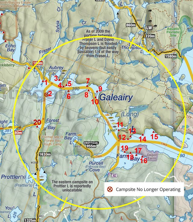
 Galeairy Lake Campsite #2
Landing
Topography of under-water approach: Shelves of slab rock will differ in depth depending on water levels.
Impediments to disembarking from and/or unloading a canoe: At time of visit, were able to step out onto rocks. Unloading is on to rocks level with campsite.
Topography to tent sites: Entire campsite is level, but close to lake level.
The campsite is totally exposed to the wind from the west,south & east ...

![]()
Landing is on south point of island ...

![]()
Campsite
Regular or low-maintenance: Regular
Size of open area: Entire campsite is exposed to the sky.
Extent of tree cover: Minimal trees are limited to the very rear (north).
Degree of levelness: Level grassed area comprises the entire area around the firepit.
Number of level tent sites: At least 3 tent sites, but with no effective drainage.
The exposed shores do give a good view of the lake ...

![]()
There are only a couple of trunks to attach tarp ropes to ...

![]()
West winds have brought down all the island's larger trees. Note the small yellow sign toward the thunderbox ...

![]()
The thunderbox is located amidst surviving smaller trees, with a view of the lake to the west ...

![]()
North exposure: remnants of the island's forest.
East exposure: Open to the lake.
South exposure: Open to the lake.
West exposure: Open to the lake.
General description: A wind-ravaged and highly exposed island campsite. The view is great and bug-reducing breezes will prevail. However, being close to the water and highly exposed, its certainly not good in cold, windy and/or rainy weather. Its overall impression is one of 'devastation'. Long grass around the firepit attests to the campsite not being used very much.
Overall accessibility: Landing access is easy, as is access throughout the campsite .. with a rolling trail amidst the fallen trees to the thunderbox.
Thanks to Jeffrey McMurtrie of Jeff'sMap for supplying the base-layer map component by Creative Commons licensing.
Submitted by Barry Bridgeford .. September 2013 .. Visited June, 2013