 Eustache Lake Campsite #3 Lat.- Long.: N45 55 48.3 W78 06 30.0
Landing
Topography of under-water approach: South-West facing landing, fist-sized rock bottom close to shore with sandy/silt footing in deeper (1.5’+) water. High or normal water the landing would be a small sloped granite rock. No obstructions to landing.
Impediments to disembarking from and/or unloading a canoe: At high-to normal waterlevels, due to the angle of the rock landing, it may be slick for some shoes/sandals. Low water exposes silt/sandy bottom that be an issue.
Topography to tent sites: Slow taper uphill along sloping rock to campsite and firepit area. Roughly 8’ in elevation from waterfront.
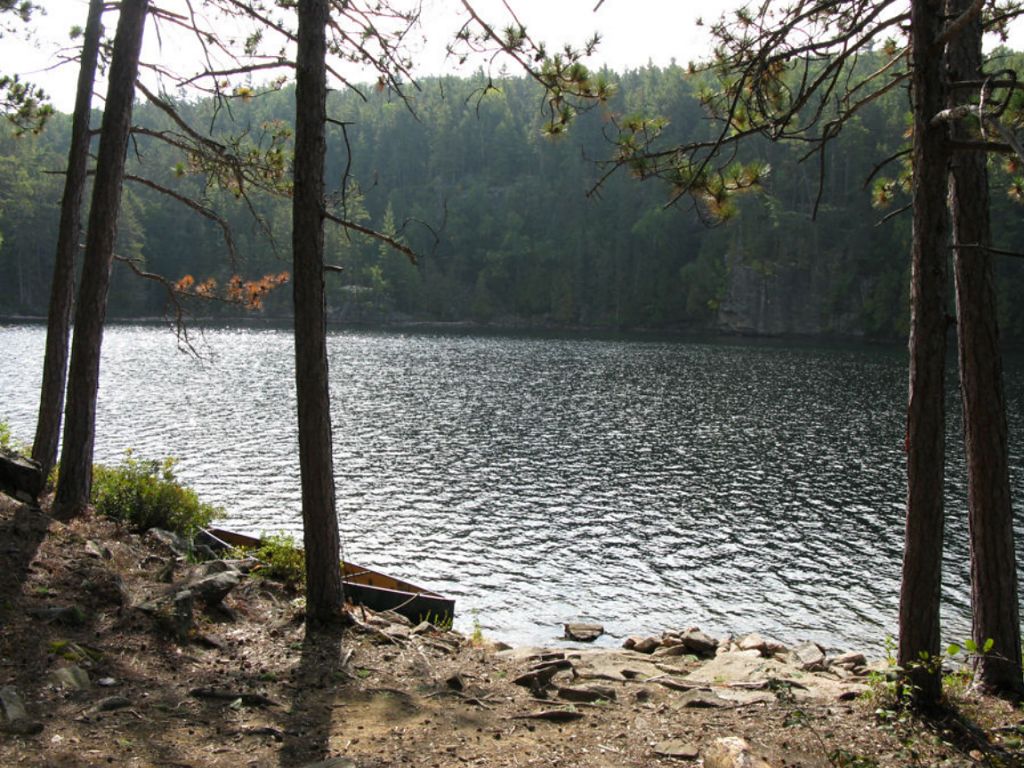
Landing area, looking south ...
![]()
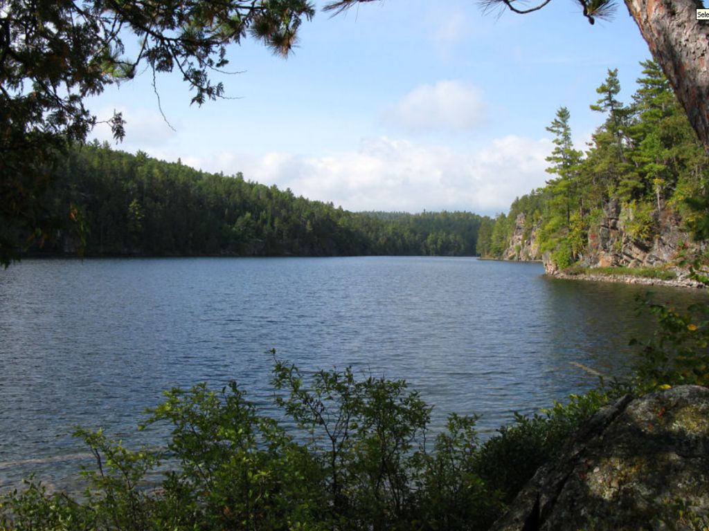
Looking west towards narrower western end of lake ...
![]()
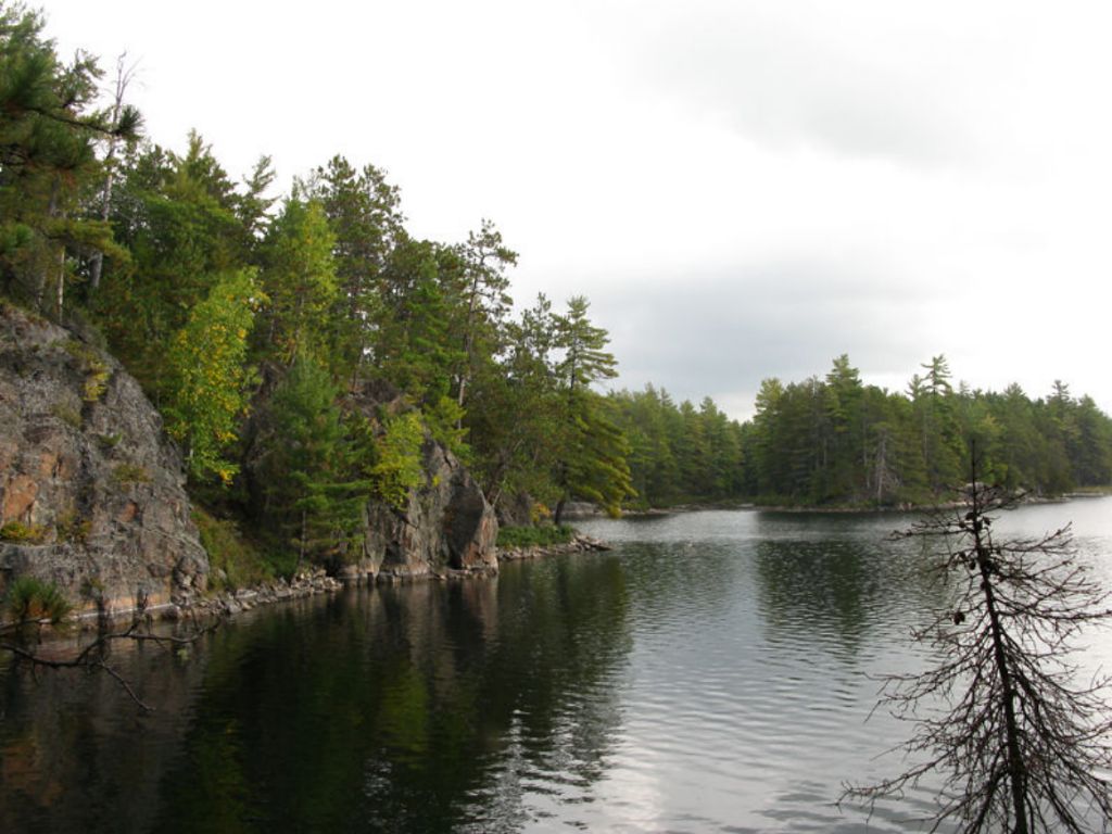
Looking south-east towards small finger bays ...
![]()
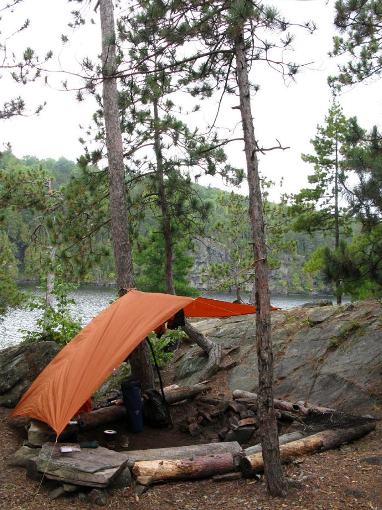
A number of 6’ to 8’ redpine trunk sections delineated the seating surrounding the firepit ...
![]()
Campsite
Campsite maintenance: low.
Size of open area: 120’ x 100’.
Extent of tree cover: 70% canopied over tent/kitchen area.
Degree of levelness: Very flat around firepit and tenting area.
Number of level tent sites: At least 3 flat sites adequate for3-4 man sized tents.
North exposure: Protected from the North winds due to proximity to northern cliffs and redpine forest.
East exposure: None - Protected from eastern winds as campsite backs-on to redpine forest and cliffs.
South exposure: Southern exposure from canoe landing only, can look south down to the end of the lake.
West exposure: From canoe landing only as the campsite firepit and tentsites protected by being nestled behind large west-facing rocky hump + thing mixed forest before lake’s shoreline.
General description: Good campsite, nicely protected tenting and cooking area, no table but adequate seating around firepit. A number of grills were present. Firepit well protected from any wind however the rain water tended to drain off the western shield rock and drain into the footing area. Great sunset views. Thunder box located east of campsite within 20’ of water’s edge, in a depression (and in need of replacement). No issues with firewood.
Overall accessibility: Good.
North of firepit area .. one of the 3 tent locations ...
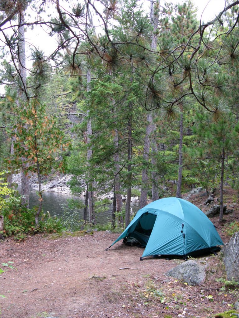
![]()
10 meters behind first tenting area .. 2nd large and flat tent area ...
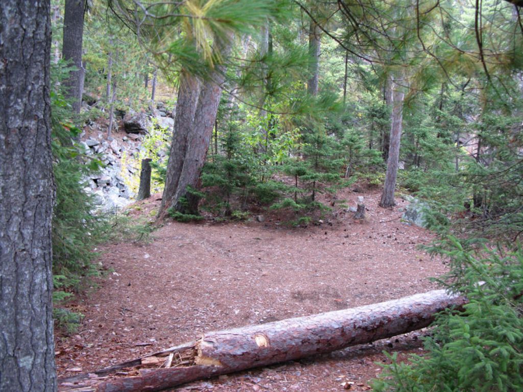
![]()
3rd tenting area .. highest on the site .. 15+ meters east of firepit ...
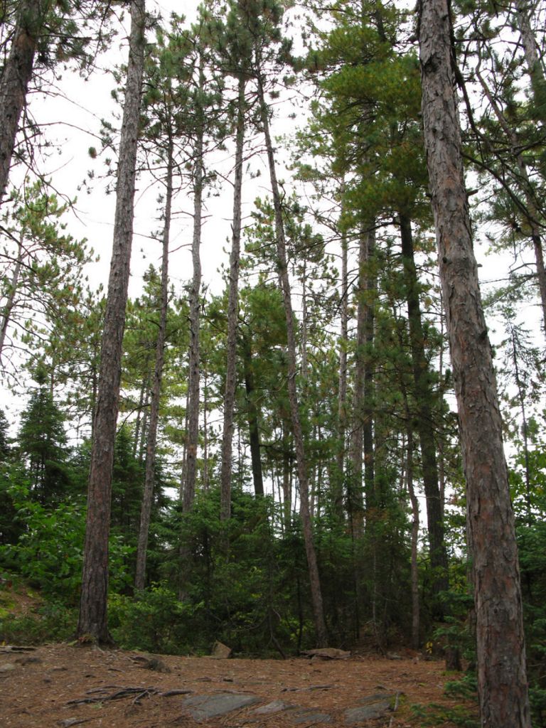
![]()
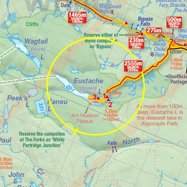
Thanks to Jeffrey McMurtrie of Jeff'sMap for supplying the base-layer map component by Creative Commons licensing.
Submitted by Stephen Molson, October 2009 .. visited Sept 23th - 25th 2009.