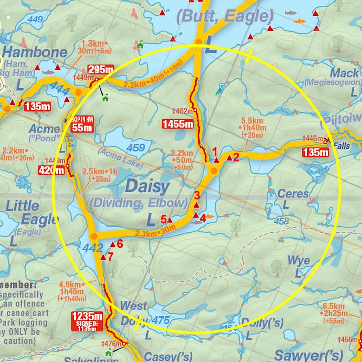
 Daisy Lake Campsite #5
Landing
Topography of under-water approach: Shallow slope, with a few paint-scaper rocks.
Impediments to disembarking from and/or unloading a canoe: Shallow in-water "beach" is narrow. Side-ways unload is on to a steep grade of solid rocks.
Topography to tent sites: Trail with moderate grade curves up behind rock point, to the fire-pit area.

|
|
| Campsite from the water, with landing to the right of rock point. | |

|
|
| Trail curving up from landing to the campsite. | |
Campsite
Campsite maintenance: Regular.
Size of open area: Very large.
Extent of tree cover: 30%.
Degree of levelness: Entire site has a slight to large grade.
Number of level tent sites: Two tent sites, but they're not actually level.
North exposure: Forest, thunder-box and lakeshore.
East exposure: Lake.
South exposure: Lake.
West exposure: Forest.

|
|
| Fire pit and one small tentsite close behind. | |

|
|
| Narrow second tentsite is off to one side. | |

|
|
| Looking past the firepit area and across the lake. | |

|
|
| Looking down the rock point and across the lake. | |
General description: This would be a good lunch stop or swimming location. There are no level tent sites. With its nice views, it would be great for stargazing.
Overall accessibility: Good.
Thanks to Jeffrey McMurtrie of Jeff'sMap for supplying the base-layer map component by Creative Commons licensing.
Submitted by John Barber .. Visited, 2021 .. Submission September, 2021