 Daisy Lake Campsite #3
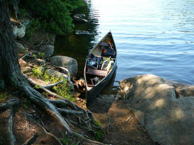
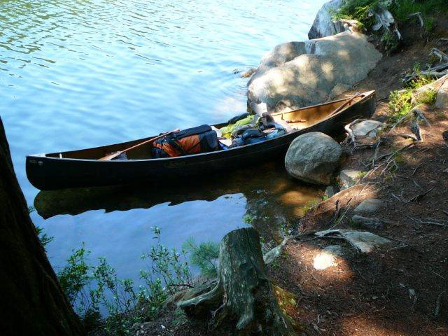
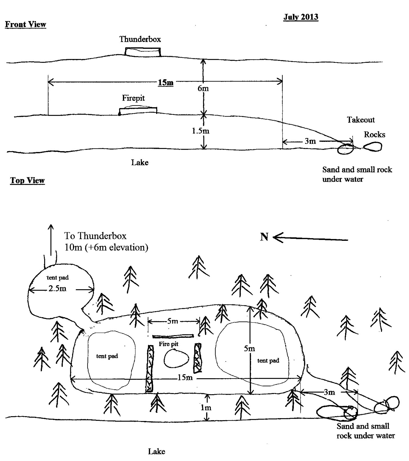
Landing
Topography of under-water approach: Sand with some larger rocks present.
Impediments to disembarking from and/or unloading a canoe: Large rocks on either side of narrow unloading zone.
Topography to tent sites: Rocks and exposed roots for 3m.
Takeout looking from site ...
Takeout looking toward site ...
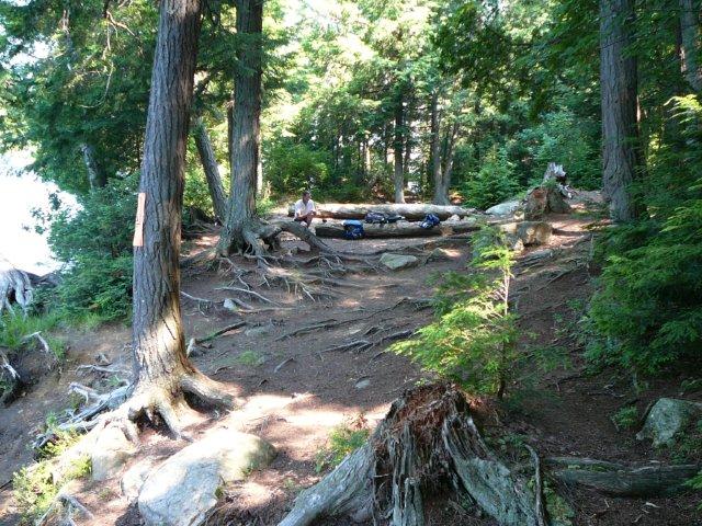
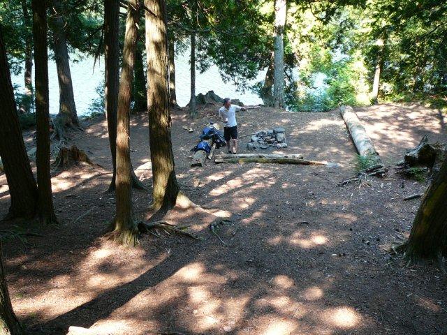
Campsite
Regular or low-maintenance: Regular
Size of open area: 15m x 5m.
Extent of tree cover: Good tree cover, with exposure to lake.
Degree of levelness: Good.
Number of level tent sites: 3.
North exposure: Trees.
East exposure: Trees.
South exposure: Trees
West exposure: View of lake (across narrows to mainland, which blocks sunset).
General description: Small site, quite flat with 3 good tent pads. Little or no sun until afternoon, no sun late in afternoon due to height of trees and close proximity to western shore of Daisy Lake.
Overall accessibility: Good, once past 2 large rocks at takeout. Steep climb to thunderbox which is located directly behind site. Thunderbox can be seen from site.
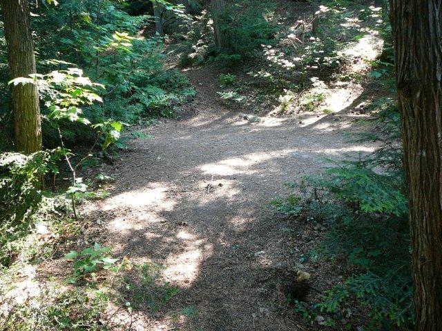
View of rise from takeout to site ...
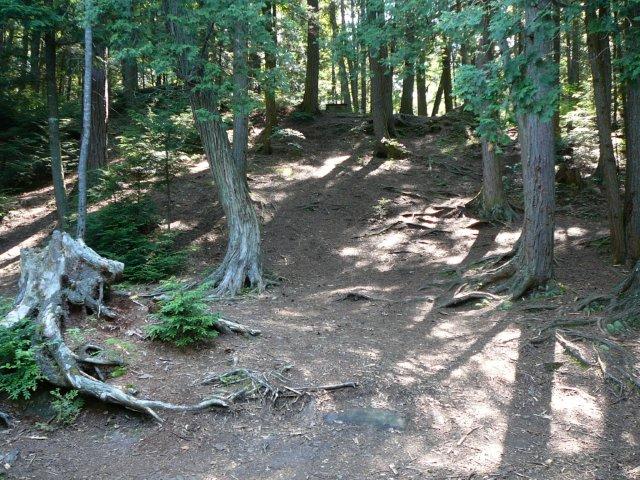
Main site from thunderbox ...
Small tent pad ...
View of thunderbox from firepit ...
Schematic of campsite ...
![]()
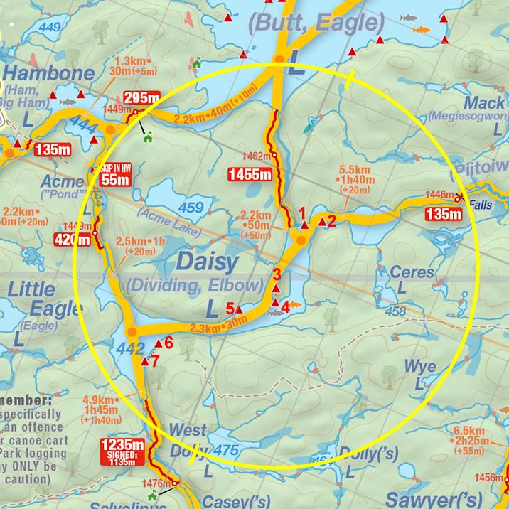
Thanks to Jeffrey McMurtrie of Jeff'sMap for supplying the base-layer map component by Creative Commons licensing.
Submitted by Chris Taylor, August 2013 ... visited July 2013.