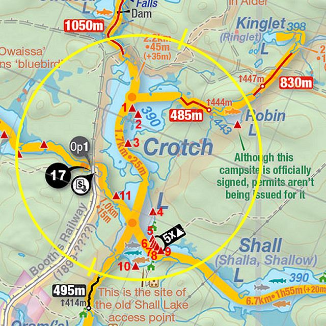
 Crotch Lake to Robin Lake Portage
Length of portage: 485m
Portage maintenance regular or low: Regular.
Elevation above Sea Level @ Crotch Lake is 390 meters.
Elevation above Sea Level @ Robin lake is 443 meters.
Difference in elevation: 53 meters.
Elevation of highest point: 443 meters. Overall rise/fall: 53 meters.
Landing at Crotch Lake
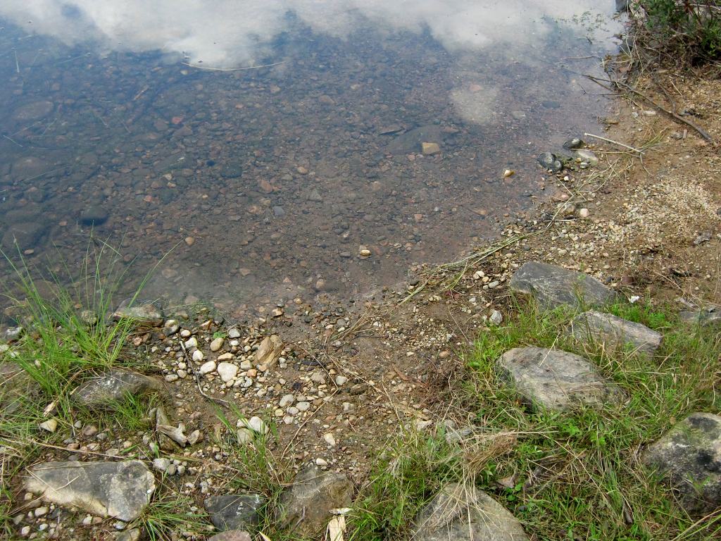
Topography of under-water approach: Gentle shallow slope of gravel and pebbles.
Impediments to disembarking from and/or unloading a canoe: No impediments. In-water area will hold 3 or 4 canoes.
Topography of the ascending grade: Moderate slope close to landing, which quickly becomes steeper as portage heads inland.
Impediments to moving gear to portage trail: On-shore clear area is small, so gear and empty canoes should be brought well inland so as to not clog the landing or portage.
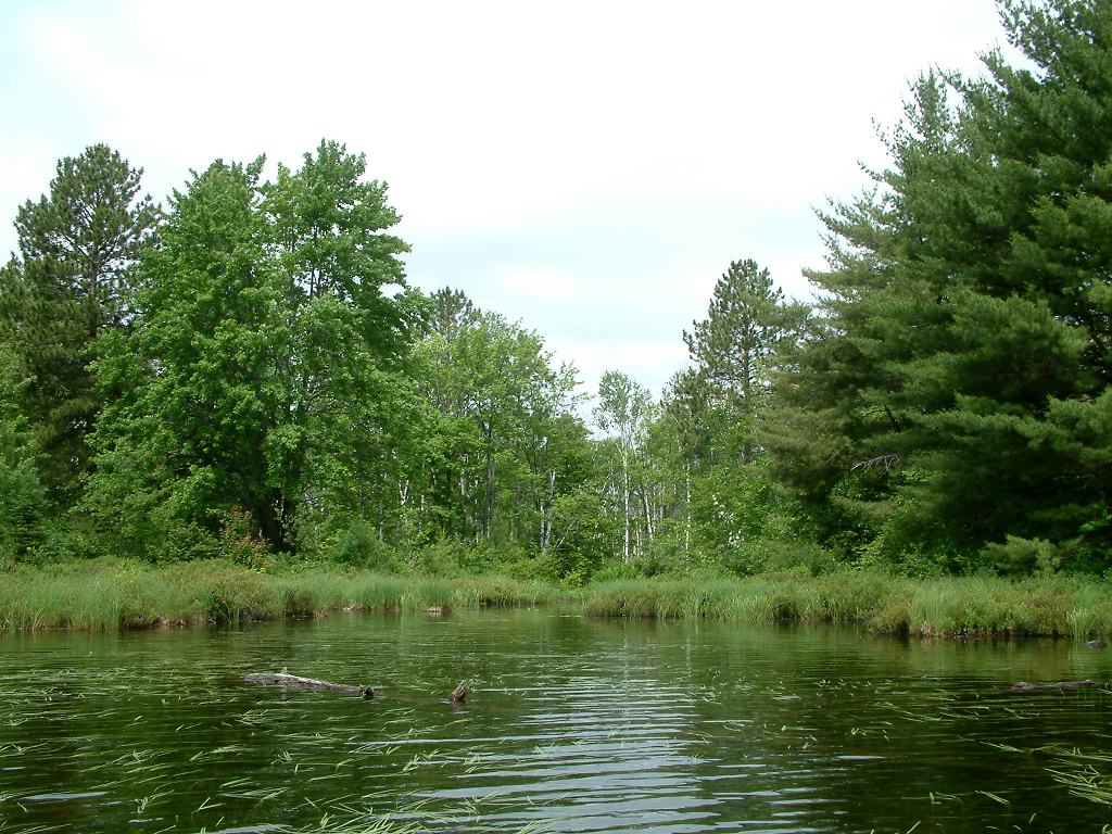
View of the landing on Crotch Lake, from the water ...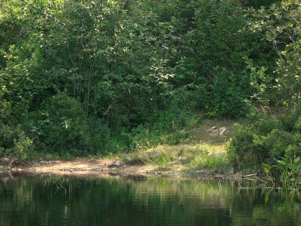
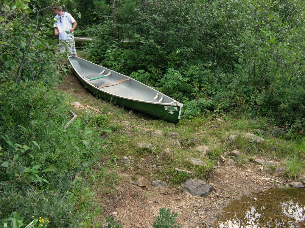
Portage Trail
General description: The portage is moderately steep, steadily rising 53 meters in 485 meters.
Topographical impediments to travelling: Being a lightly used portage, ground vegetation tends to grow over some of the portage's rocks and roots. While there aren't areas of loose gravel or sand, care should be exercised, specially in wet conditions.
Areas susceptible to impact by periods of rain or beaver flooding: Drainage of Robin Lake is normally off to one side away from the portage and doesn't impact the trail.
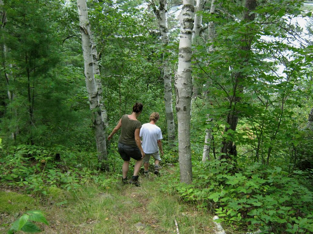
Beginning of the portage, looking back to Crotch Lake ...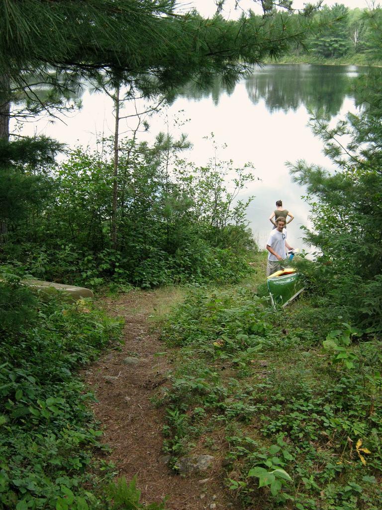
Landing at Robin Lake
Topography of under-water approach: The landing at Robin Lake is quite unique. The approach is actually a narrow, somewhat deep channel which abuts a well-grassed old, but substantial beaver dam.
Impediments to disembarking from and/or unloading a canoe: As long as the lake retains its normal level, the edge of the dam acts as a good put-in/take-out spot. However, the narrowness of the approach channel would limit canoe access to 'one-at-a-time'.
Topography of the ascending grade: There isn't any grade ascending from the landing. The portage's approach is all uphill right to the landing atop the old beaver dam. The dam circles around to the east, is really quite long and holds back a considerable depth of Robin Lake. If the dam were ever breached and/or not maintained, Robin Lake could very quickly become a much smaller muddy lake.
Impediments to moving gear to portage trail: There are no impediments. The limited use of this portage has allowed a lush little area of grass to be retained atop the beaver dam .. quite an enjoyable resting spot.
Grassed edge of the dam with channel to Robin Lake ...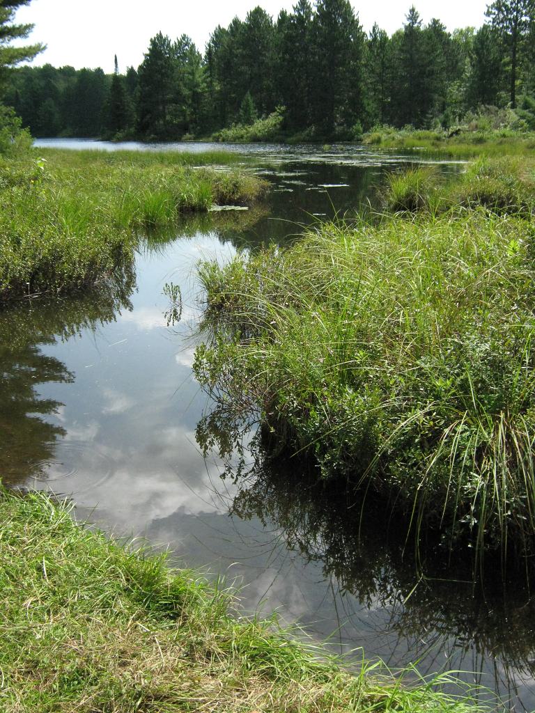
Thanks to Jeffrey McMurtrie of Jeff'sMap for supplying the base-layer map component by Creative Commons licensing.
Submitted by Barry Bridgeford, visited 2010, submitted March, 2011