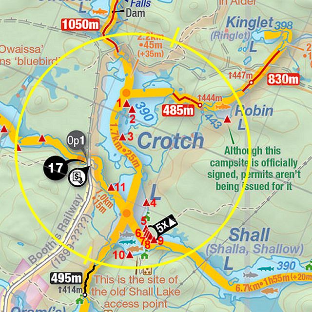
 Crotch Lake Campsite #6
Landing
Topography of under-water approach: Sand and gravel beach-like slope.
Impediments to disembarking from and/or unloading a canoe: Nearby shrubs confine the landing.
Topography to tent sites: Loose gravel rise.
 |
|
| Narrow sand and gravel slope from landing to campsite. | |
 |
|
| Position of firepit relative to landing (just beyond) and the view of the lake beyond that. | |
 |
|
| Side view of the firepit area. | |
 |
|
| Three tentsites surround the firepit. | |
 |
|
| A fourth tentsite is located further to the south. | |
Campsite
Campsite maintenance: Regular.
Size of open area: Campsite is spacious under the open canopy of pine trees, approximately 25' x 60'.
Extent of tree cover: Pine canopy over majority, but open understory is breezy.
Degree of levelness: Actual campsite is level.
Number of level tent sites: 4 good sized tent sites.
North exposure: Trees.
East exposure: Trees.
South exposure: Trees.
West exposure: Trees and shrubs break the view of the lake.
General description: One of five campsites that were originally the shoreline part of an old drive-in campground. This campsite more-or-less runs into the adjacent campsites.
Overall accessibility: After the slope up from the landing, the campsite is level.
Thanks to Jeffrey McMurtrie of Jeff'sMap for supplying the base-layer map component by Creative Commons licensing.
Submitted by Barry Bridgeford .. Visited July, 2023 .. Submission Autumn, 2023