 Clydegale Lake Campsite #2
Landing
Topography of under-water approach: Small sandy beach approaches from the south, tucked around behind rock face on campsite's west side.
Impediments to disembarking from and/or unloading a canoe: Very narrow area open between the trees which come close to the water.
Topography to tent sites: Considerable narrow trail climbs amidst the trees to the campsite.
One has to approach from the south through the waterweeds to a small clearing amidst the shore's trees ...

![]()
The narrow confines of the landing would make unloading multiple canoes a bit awkward ...

![]()
While unloading isn't difficult, stowing more than one canoe onshore could be ...

![]()
The climb to the campsite is this narrow slippery trail (looking down) amidst the trees ...

![]()
Campsite
Campsite maintenance: regular
Size of open area: Small and confined.
Extent of tree cover: Substantial overhang and shade all around the campsite.
Degree of levelness: Firepit and tentsite areas are level.
Number of level tent sites: Tentsite areas for three medium-sized tents.
North exposure: Solid trees block the north wind.
East exposure: Solid trees block the east wind..
South exposure: Numerous trees block both the south wind and any view.
West exposure: A substantial line of trees block the view. A small gap in the trees and rock ledge due west of the firepit provides a view to the west.
The first tentsite is between the top of the trail and the firepit ...

![]()
The second tentsite is immediately north of the firepit and the third is beyond it ...

![]()
General description: This campsite is surrounded and shaded by trees, to the point of being dismal and 'buggy'. The overgrowth of the trees and the state of the firepit benches indicate that it gets little use and/or maintenance. I suggest that the state of the thunderbox be checked before committing to using this campsite.
Overall accessibility: The confined nature of the landing and the long grade of the trail to the campsite are both negative accessibility issues.
This campsite could serve as a one-night stopover in a pinch. However, it wouldn't make a good destination campsite. Nor is it good for travelling with young children or "sun-worshippers".
This view is to the northwest, from a rock ledge between two pines west of the firepit ...

![]()
This view is from a small clearing part way up the trail to the campsite, looking west ...

![]()
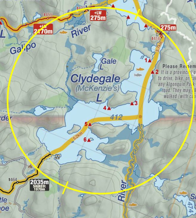
Thanks to Jeffrey McMurtrie of Jeff'sMap for supplying the base-layer map component by Creative Commons licensing.
Submission May, 2013 by Barry Bridgeford .. visited June, 2012