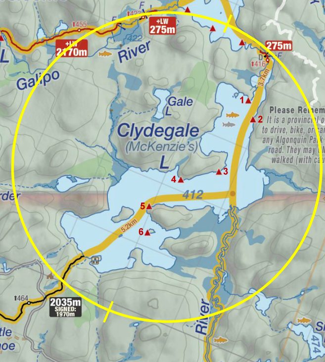
 Clydegale Lake Campsite #1
Landing
Topography of under-water approach: Sandy beach with room for 3 canoes.
Impediments to disembarking from and/or unloading a canoe: none.
Topography to tent sites: 30 meters with last 8 meters being up a moderately sloped hill.
Looking south across landing ...

![]()
View from landing area towards path to campsite ...

![]()
Campsite
Campsite maintenance: regular
Size of open area: Large.
Extent of tree cover: Moderate.
Degree of levelness: Moderate.
Number of level tent sites: 3 small tent sites (one is very close to firepit); wouldn't want tents much larger than 2-3 man.
North exposure: protected.
East exposure: protected.
South exposure: moderately exposed.
West exposure: protected
General description: Southern facing rock gets mid-afternoon sun. Surrounding water is a little marshy. Wouldn't want to swim. Large rock outcropped to the south has ok swimming, if you hike to the end of the rocks (~50 meters). Campsite has an OK view, but a few trees obstruct it slightly. The tent area is protected from the wind but hasn't got a closed-in feeling. Thunderbox is close to the tent sites. Thunderbox could use some maintenance.
Overall accessibility: Easily accessible from canoe put-in but lots of rocks to navigate to get to the water in front of the campsite.
South facing view from fire pit area ...

![]()
North facing view of fire pit area ...

![]()
North-east facing view of fire pit area ...

![]()
Thanks to Jeffrey McMurtrie of Jeff'sMap for supplying the base-layer map component by Creative Commons licensing.
Submission August, 2013 by Clare Cowan .. visited August, 2013