 Portage 915 meters - Cedar L. To Nipissing R. (Southwest of Brent, across lake)
Portage Location: from Cedar Lake to Nipissing River
Length of portage: 915m meters
Portage maintenance regular or low: Regular.
Elevation above Sea Level @ Cedar Lake ~ 308 meters
Elevation above Sea Level @ Nipissing River ~ 318 meters
Difference in elevation: 10 meter rise from Cedar to Nipissing
Portage Trail general description: Fairly good portage. Rocky, rooty and small hills, Not too strenuous.. The portage peaks at 334m for a total difference in elevation of 26m.
Topographical impediments to traveling: The portage is pretty good except for some rocky sections.
Landing at: Cedar Lake (downstream)
Topography of under-water approach: Some gravel and mud
Close view ...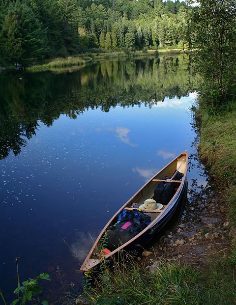
Impediments to disembarking from and/or unloading a canoe: Portage ends in a grassy area with a small step down to a gravel patch where you land/launch at.
Far view ...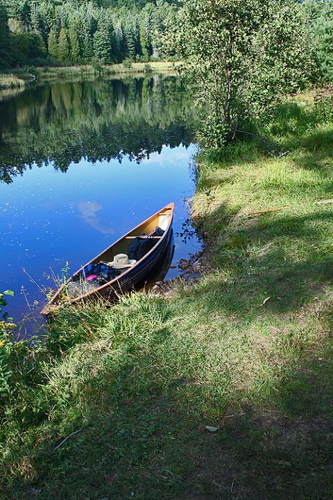
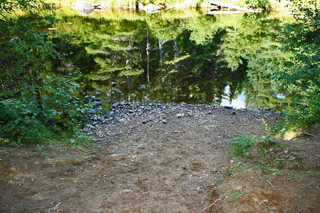
Landing at: Nipissing River (upsteam)
Topography of under-water approach: Rocks and gravel
Impediments to disembarking from and/or loading a canoe: Rocks and gravel.
Note: When paddling from upstream, .. there is a false landing and a true landing. The false landing has a steep step beside it. If you continue downstream past this landing and around a bush, you will find the true landing that has a nice slope up from the water to the portage path.
False landing ...
True landing ...

Thanks to Jeffrey McMurtrie of Jeff'sMap for supplying the base-layer map component by Creative Commons licensing.
Submitted by Sean Rowley, visited: 2009, submitted Sept 12, 2009