 Casey Lake Campsite #1
Landing
Topography of under-water approach: Central area of sloping muck with small rocks, plus sloping rocks to either side.
Impediments to disembarking from and/or unloading a canoe: Choice of stepping into mucky 'beach' or stepping onto gunwale-height rock.
Topography to tent sites: Slight and manageable slope up to tentsite.
Choice of landing types ...

![]()
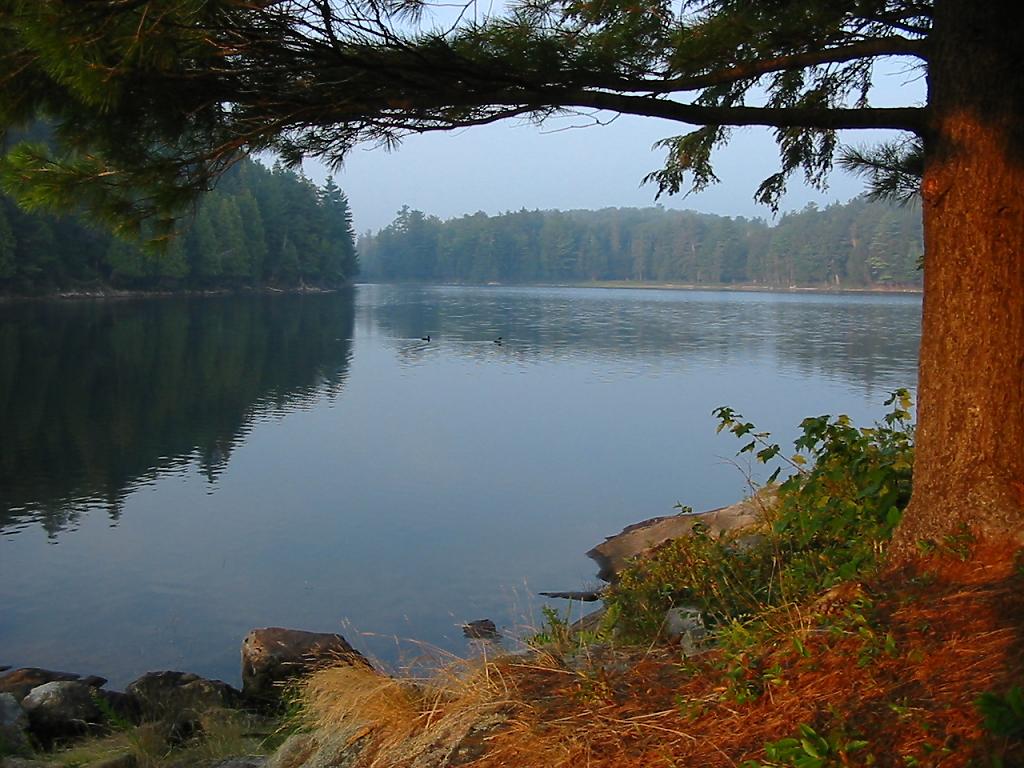
Looking east to the rising sun ...

![]()
Looking west down the far bay ...
![]()
Campsite
Campsite maintenance: regular
Size of open area: 50' x 50' .
Extent of tree cover: 35% canopied toward the rear. Seating/firepit area would benefit from tarp if it was rainy.
Degree of levelness: Tentsite area is level. Kitchen area has some grade change, but not terrible.
Kitchen area and tentsites behind ...

![]()
Number of level tent sites: Easily three large tents.
North exposure: Tent area protected from north winds.
East exposure: Somewhat open to easterly winds.
South exposure: Good southerly exposure.
West exposure: West view is across the lake. Late afternoon sun disappears behind trees.
General description: A good sized site, but not particularly attractive. Its located in a small 'confined' bay of a small lake, resulting in a limited view. A decent one-night stop-over.
Overall accessibility: Good.
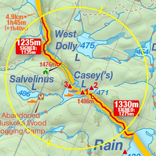
Thanks to Jeffrey McMurtrie of Jeff'sMap for supplying the base-layer map component by Creative Commons licensing.
Submitted by Barry Bridgeford .. Visited Summer 2004 .. Submission January 2, 2009