 Burnt Island Lake Campsite #30
Landing
Topography of under-water approach: With typical water levels and waves, a careful "feet-in-the-water" landing amidst the rocks is to be expected.
Impediments to disembarking from and/or unloading a canoe: The rocky bottom and shore means that care is required.
Topography to tent sites: A rise of approximately 5 feet leads to the campsite.
The site is on a rocky point with west and south exposures ...

![]()
Care must be taken landing amidst the rocks ...

![]()
A slight rise gets one to the campsite level ...

![]()
Campsite
Regular or low-maintenance: Regular
Size of open area: Main level area is approximately 40 x 40 feet.
Extent of tree cover: Light tree cover gets thicker toward the rear of the campsite.
Degree of levelness: Generally level surface.
Number of level tent sites: Room for 5 tents.
The firepit is on the actual point, under some trees, and open to south & west winds ...

![]()
Some tentsites are near to the water, others more sheltered ...

![]()
Toward the rear is another tentsite and a more open section of the forest ...

![]()
North exposure: Forest and rise in the grade.
East exposure: Forest.
South exposure: View of the lake.
West exposure: Beyond a few small trees is the open lake.
General description: The campsite is level and somewhat spacious. it is open to south and west winds. It lacks sunning rocks, easy water access and sunset opportunities.
Overall accessibility: Disembarking and unloading could be a real challenge.
View SSW from the firepit area ...

![]()
View westward from the westmost tentsite ...

![]()
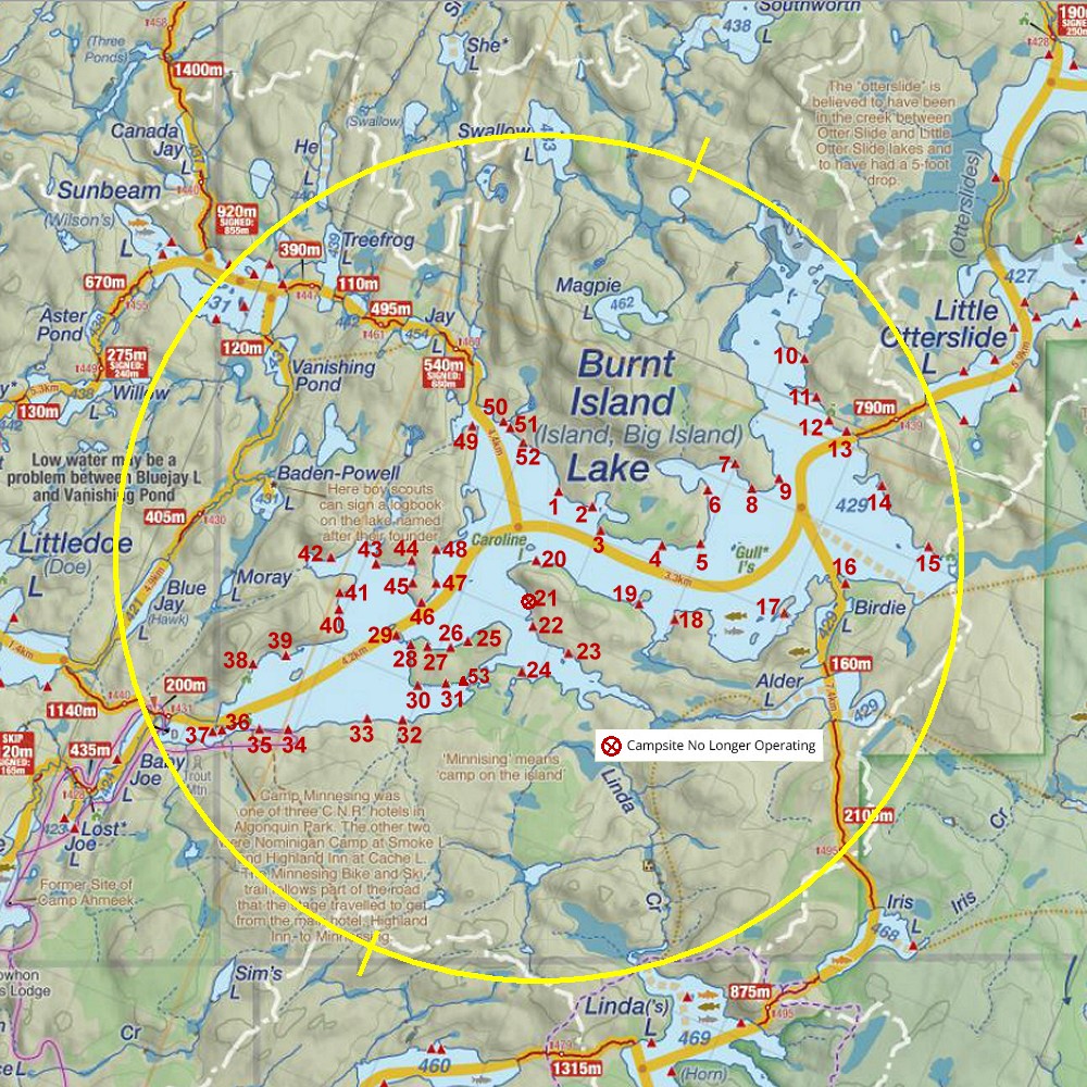
Thanks to Jeffrey McMurtrie of Jeff'sMap for supplying the base-layer map component by Creative Commons licensing.
Submitted by Barry Bridgeford .. January 2014 .. Visited July, 2013