 Portage 300 meters - Big Trout Lake to Longer
Portage Location: from Big Trout Lake to Longer Lake.
Length of portage: 300m
Portage maintenance regular or low: Regular.
Landing at Big Trout Lake: N45 46 59.0 W78 39 17.9 Elevation: ~405 m above Sea Level
Landing at Longer Lake: N45 47 06.4 W78 39 25.6 Elevation: ~396 m above Sea Level
Rise/Fall Overall: 9 meter drop in elevation from Big Trout Lake – to Longer Lake .. highest Z is 412 meters
Cross Section of Portage Elevation changes ...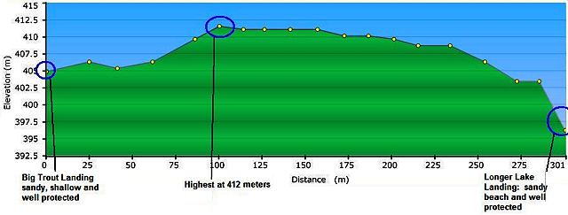
Landing at: Big Trout Lake Lake (upstream)
Topography of under-water approach: Very pleasant sandy beach landing. Water shallow and landing well protected. Good footing – no mud, shrubbery or thick duff.
Impediments to disembarking from and/or unloading a canoe: None. But,a strong south-east winds may make this landing fun – well protected from most winds.
Available area for managing canoes: room for at least 3 canoes + gear at a time. 20’ x 30’ flat grassy area for gear placement and storage.
Impediments to moving gear to portage trail: None .. spacious gear and boat managing area.
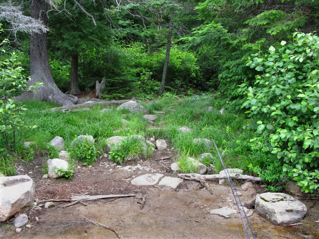
Big Trout landing of the portage to Longer Lake ...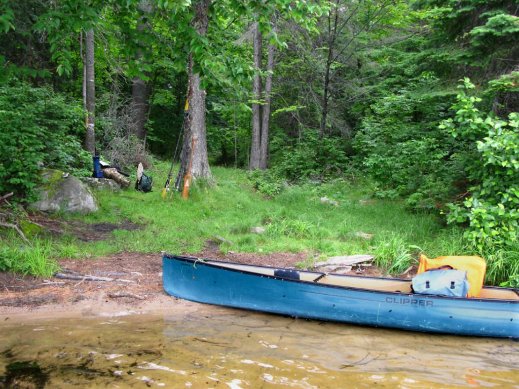
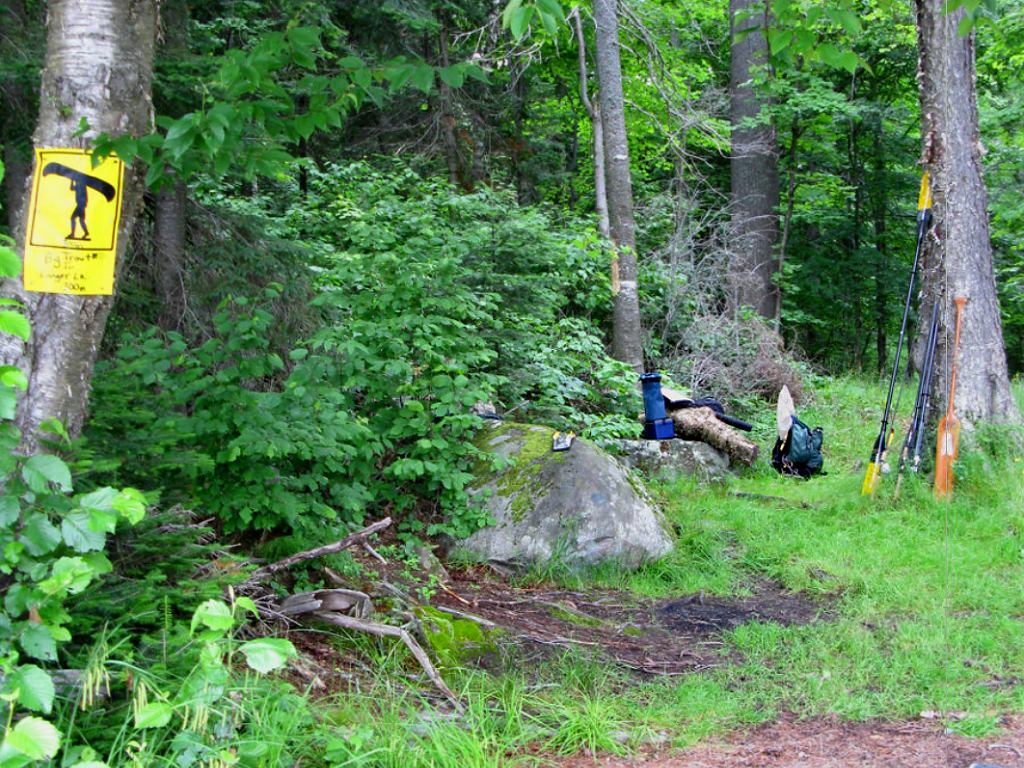
Topography of the ascending grade: a short 50 meter stretch of a slight grade uphill before the portage levels out and begins slow down-grade to the Longer Lake side. Portage is generally firm ground through grass and hard packed earth – there are a few rough boardwalks over the wet or muddy section closer to the Longer Lake side. No steep rises, portage is well maintained.
Portage Trail general description: Fairly straight, light grade easy portage with no steep elevation sections. Ground is composed mostly of hard-packed earth and small rock surrounded by grasses. A few boulders on the Longer Lake side closer to the landing. No blowdowns or detours were encountered.
Topographical impediments to traveling: None.
Areas susceptible to impact by periods of rain or beaver flooding: Early spring typical conditions would be high water on landing areas but don’t expect any flooding along the portage itself – no low lying or earthy sections prone to flooding. Some grassy sections may be slick after a rain and earth in spots may turn muddy depending on conditions. Short 5-10 meter section of boardwalks existed closer to Longer Lake where a bit of ground seepage (springs) were observed.
Landing at: Longer Lake (downstream)
Topography of under-water approach: Very pleasant sandy beach landing. Water shallow and landing well protected. Good footing – no mud, shrubbery or thick duff.
Impediments to disembarking from and/or unloading a canoe: None .. well protected from most winds.
Available area for managing canoes: room for at least 2 canoes + gear at a time.
Impediments to moving gear to portage trail: None .. spacious gear and boat managing area.
Landing at Longer Lake, looking north ...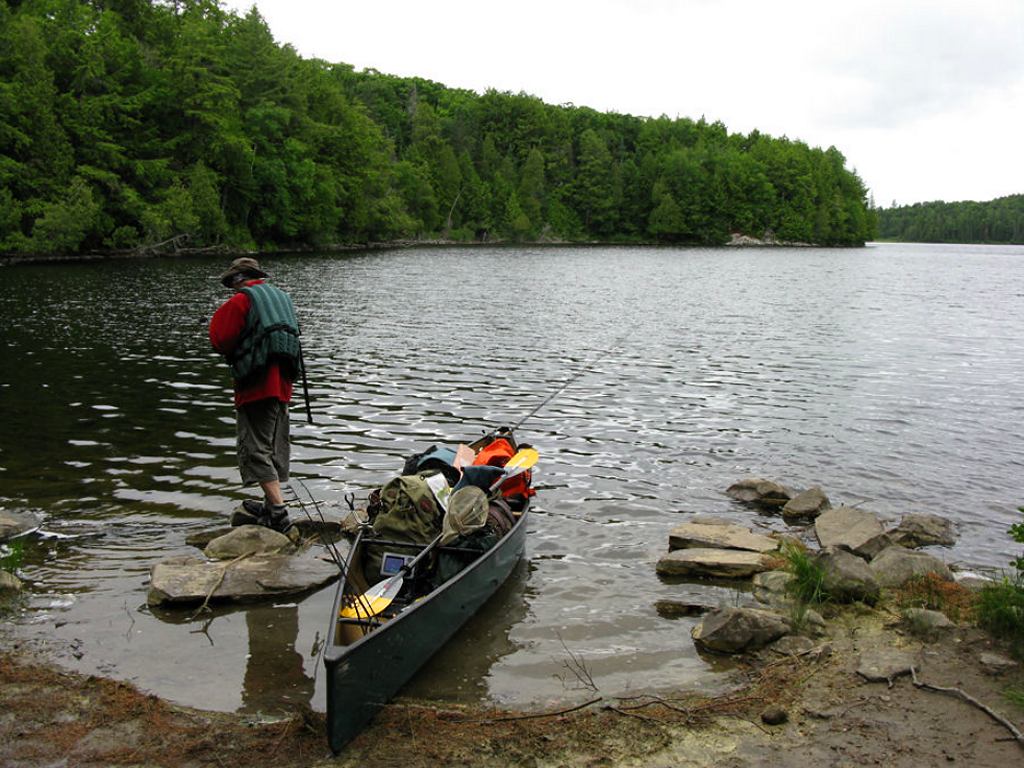
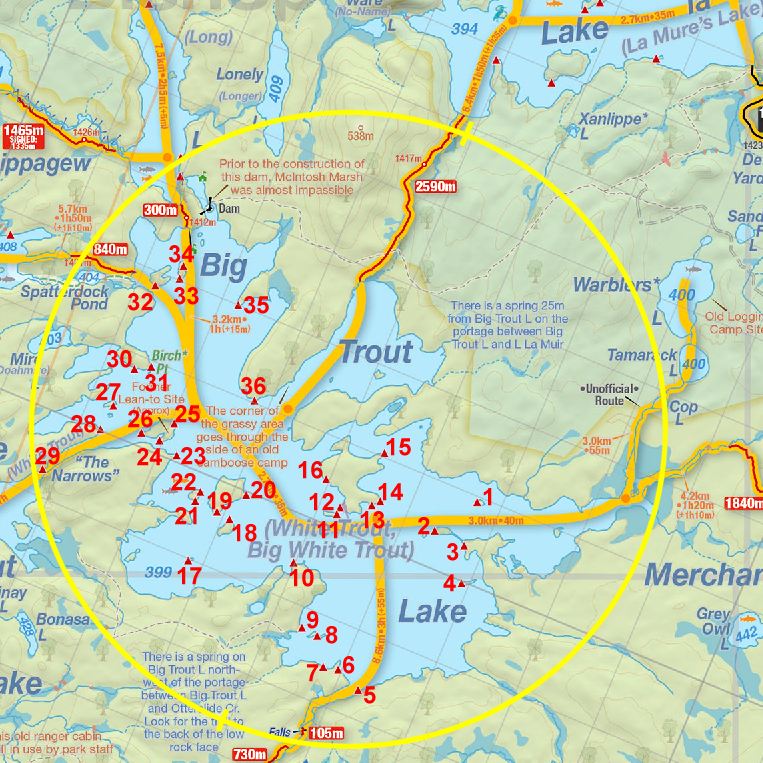
Thanks to Jeffrey McMurtrie of Jeff'sMap for supplying the base-layer map component by Creative Commons licensing.
Submitted by Stephen Molson, visited 2009, submitted January, 2010