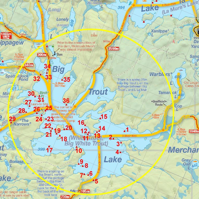
 Big Trout Lake Campsite #14
Landing
Topography of under-water approach: Two possible landings exist. One off the rocky point facing east. The other is along the island’s protected north shore, facing north. East facing landing is over deeper (3’+) water right at the shore along granite rocks and boulders. North landing is along shallow fist-sized rock, sand and boulder bottom.
Impediments to disembarking from and/or unloading a canoe: During normal summer levels both landings are along sloped shorelines with little gear storage areas. Gear had to be hauled up further on shore to flat or at least more reasonably safer management areas. West landing may be slippery and a bit more tricky on account of the large sloped rocks. The north landing is more protected and overall the better choice (depending on wind direction) on account of its proximity to the campsite.
Topography to tent sites: Both are short but steep taper uphill along grassy bank. Roughly 10’ in elevation from waterfront.
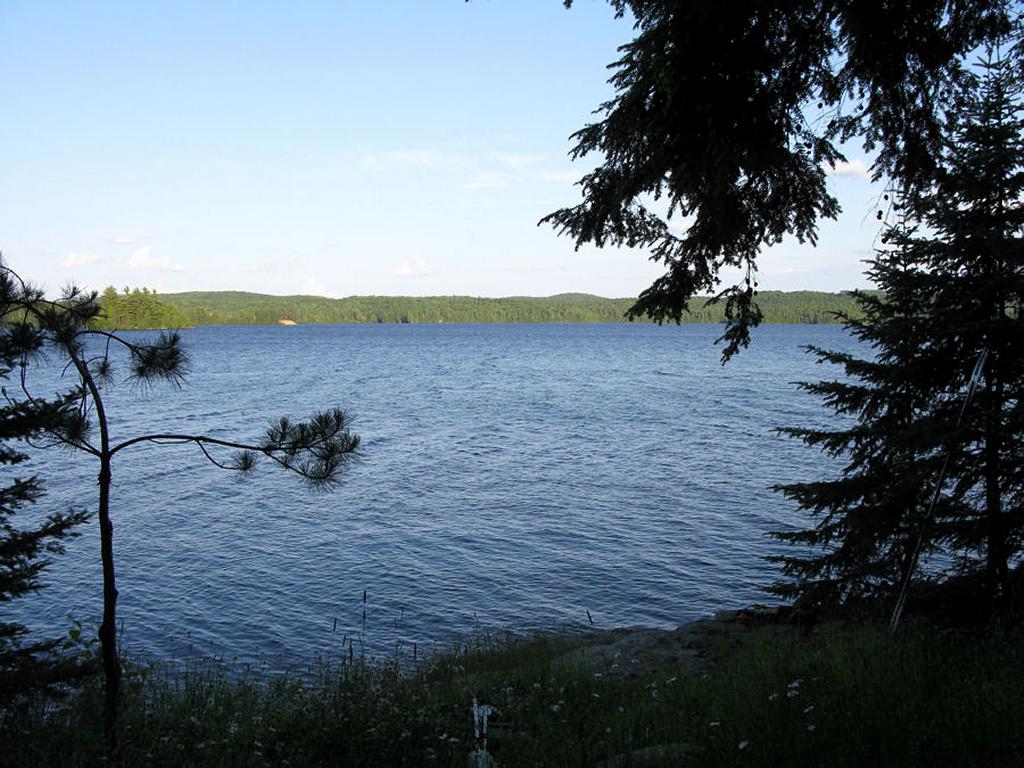
East landing view from campsite back down the length of the lake ...
![]()
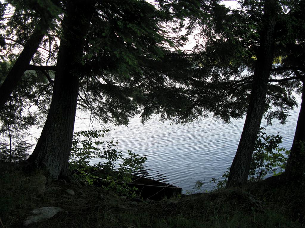
Site’s well-protected north landing ...
![]()
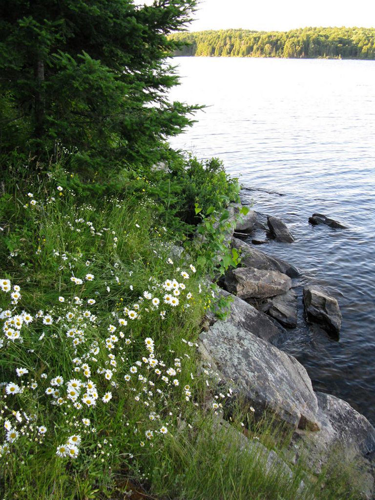
Site’s eastern landing area, looking north ...
![]()
Campsite
Regular or low-maintenance: Regular Maintenance.
Size of open area 80’ x 50’.
Extent of tree cover: 30% canopied over tent/kitchen area.
Degree of levelness: Campsite built on a rounded knoll, not very flat.
Number of level tent sites: At least 2 slightly angled sites adequate for 3-4 man sized tents.
North exposure: Landing and site adequately protected from moderate north winds due to proximity to northern shoreline. Strong (30km+) north winds may be an issue.
East exposure: Landings (most notably the east one) and site fully exposed to the eastern winds.
South exposure: North landing well protected from the south winds, eastern landing fully exposed. Campsite protected from the south winds on account of the forest strip south of site.
West exposure: Site and both landings well protected from the west winds due to forest cover behind site.
General description: A poor campsite overall, appeared to be seldom used. Firepit dug 2’ directly into the ground with no rock perimeter. No flat spots for tent setup. Ground covered in grass and both landings were poor. No tables and the seating was limited to 1 log around badly designed/dug firepit. Thunder box was in poor condition, located 10m west of site. No grill present. Poor sunset views but good sunrise exposure. Vistas limited to eastern end of lake and a small portion of the bay’s north shoreline. No issues with firewood. Seasonal wildlflowers growing along eastern shoreline (daisies). Would avoid this campsite in the future for all but emergency use.
Overall accessibility: Poor
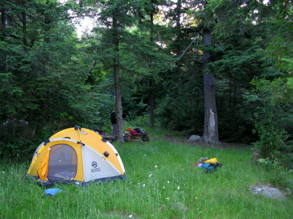
Campsite’s open, grassy tenting area, firepit/kitchen in background ...
![]()
Thanks to Jeffrey McMurtrie of Jeff'sMap for supplying the base-layer map component by Creative Commons licensing.
Submitted by: Stephen Molson .. Visited: July 2009 .. Submission: March, 2010