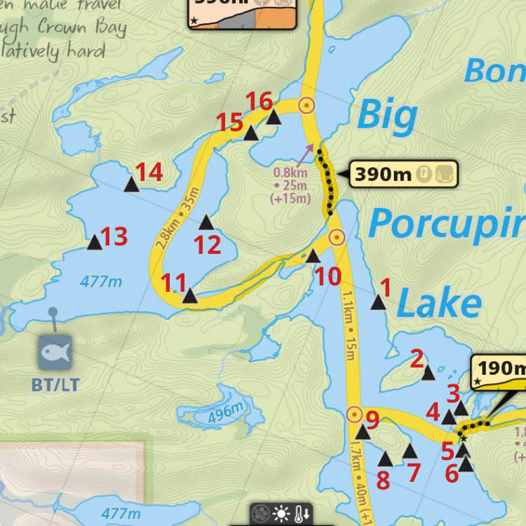
 Big Porcupine Lake Campsite #5
Landing
Topography of under-water approach: On the south side of point, a large rock slopes down into water .. with a small area floored with sand and gravel.
Impediments to disembarking from and/or unloading a canoe: With one's feet in the water, the sloped rock serves for unloading .. afterwhich one's canoe can be lifted up on to the rock.
Topography to tent sites: 20' rise up a large rock slope to the actual firepit and tentsite area.
 |
|
| - Landing is where the sloped rock enters the water by the vegetated area. | |
 |
|
| - Sloped rock of the landing could be slippery in rainy conditions. | |
 |
|
| - Firepit area is located to the left of the tree with the campsite sign. | |
Campsite
Campsite maintenance: regular
Size of open area: 50' x 70'.
Extent of tree cover: Three pines provide partial cover of the firepit area, while there's no cover over the open grassy tentsite area beside it. There's a second tentsite area which is under tree cover to the rear.
Degree of levelness: The firepit and first tentsite area is generally level.
Number of level tent sites: Two tents could be squeezed on the open grassed area (but without trees for tarp support). A third tentsite is located back in the trees.
North exposure: Protected from the worst of the north winds by intervening trees.
East exposure: Inland forest blocks the east winds.
South exposure: Limited protection to the south.
West exposure: Fully open to the west wind and sunset.
 |
|
| - The firepit provides an open view to the southwest. | |
 |
|
| - Two tents could be located here .. but without trees for tarp tie-downs. | |
 |
|
| - The only treed tentsite is well back in the forest. | |
General description: OK for small group. However, without tie-down trees at front tentsites, protection is limited.
Overall accessibility: In-water landing and steep sloped rock could be an issue.
Thanks to Jeffrey McMurtrie of Maps By Jeff for supplying the base map.
Submission July 2015 by Barry Bridgeford .. visited June, 2015