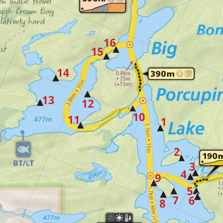
 Big Porcupine Lake Campsite #10
Landing
Topography of under-water approach: North-east facing landing, large sloping rock down into water, with small area of 1' deep sand bottom. No obstructions to landing.
Impediments to disembarking from and/or unloading a canoe: Take care when stepping out on to sloped rock if it's wet.
Topography to tent sites: 15' rise to actual firepit and tentsite area, which is located way back into the trees.
 |
|
| - Approaching the campsite's point from the "rear" (from the west), down the channel which joins the halves of the lake. | |
 |
|
| - NE corner of the point's sloped rock landing. | |
 |
|
| - A break in the trees on the rear of the point, looking NW across the channel. | |
Campsite
Campsite maintenance: regular
Size of open area: 40' x 40'.
Extent of tree cover: 100% canopied over tent/firepit area.
Degree of levelness: Once you're back from the actual rock point, the entire site is level ..
Number of level tent sites: Plenty of tent sites.
North exposure: Protected from the north winds by intervening trees.
East exposure: While the landing is open to the east, the tentsites are protected by the intervening trees.
South exposure: Full forest to the south.
West exposure: Both point and tentsites are protected by trees.
 |
|
| - Deep into the trees is the firepit and its big reflector rock. | |
 |
|
| - Looking north, back to the point, through the tentsites' area. | |
General description: Good for large group, due to plenty of tentsites. However, there isn't any real view to enjoy in any direction. Bugs could be a problem due to sheltered nature of entire site.
Overall accessibility: Good.
Thanks to Jeffrey McMurtrie of Maps By Jeff for supplying the base map.
Submission March, 2012 by Barry Bridgeford .. visited July, 2011